


TAMPA BAY, Fla. — The National Weather Service has placed all of the Tampa Bay area under a TORNADO WATCH until 11 a.m. as severe weather is expected to roll through the area Saturday morning.
Counties included in the watch area:
- Citrus
- Hardee
- Hillsborough
- Manatee
- Pasco
- Pinellas
- Polk
- Sarasota
- Sumter
A tornado watch means conditions in the area are favorable for tornadoes (or waterspouts) and severe thunderstorms in and close to the watch area.
What to expect...
ABC Action News meteorologist Jason Adams has broken down what you can expect.
A strong cold front will head our way Saturday morning.
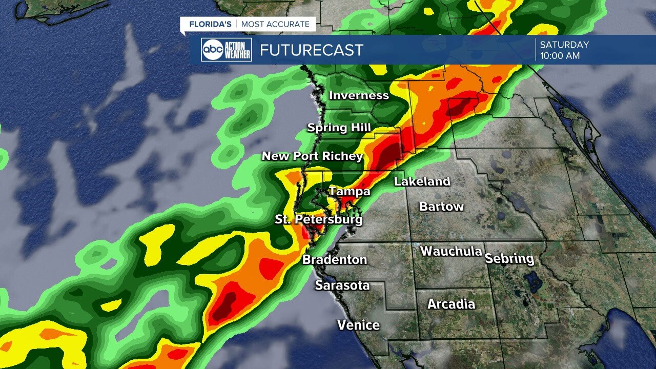
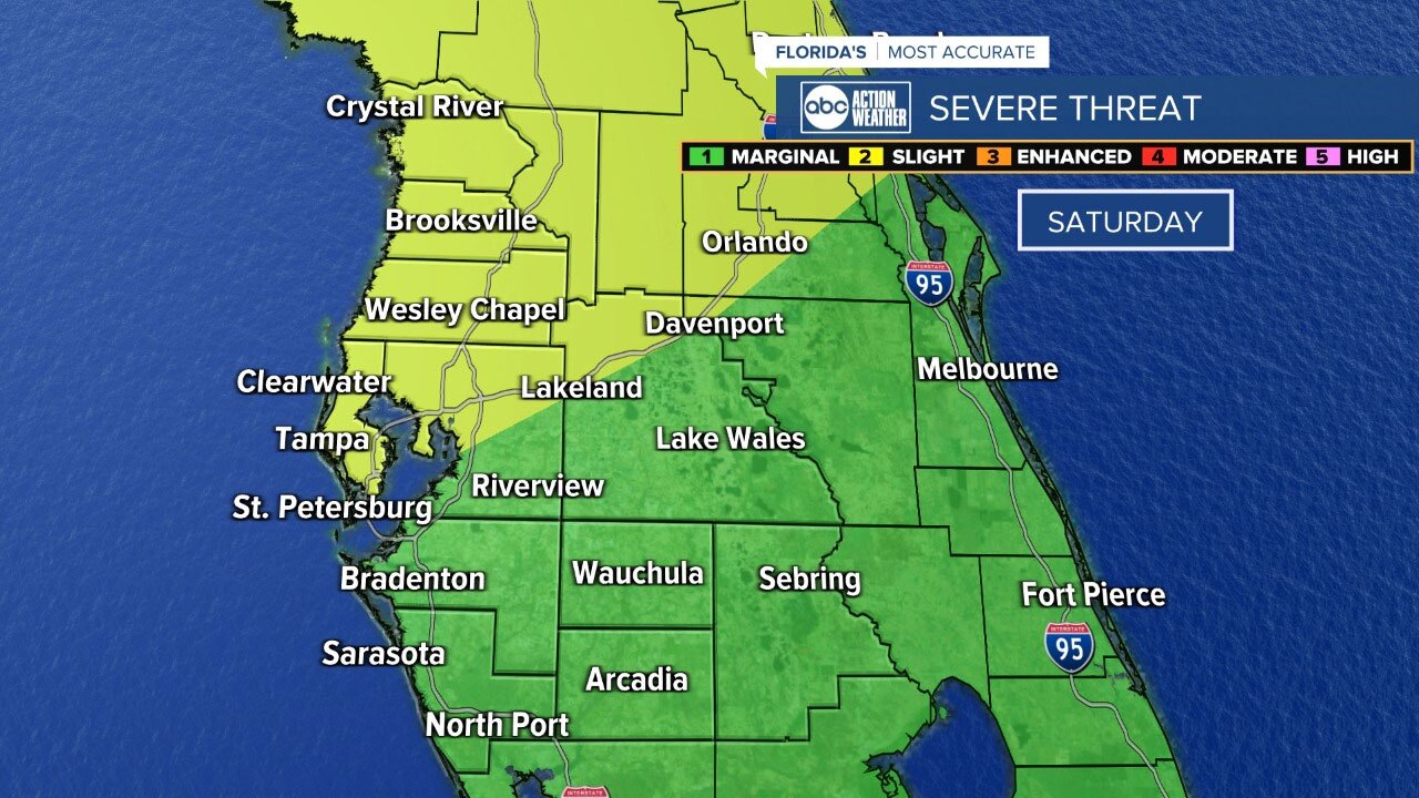
We're under a SLIGHT risk for severe weather, which is a level 1 (green) and 2 (yellow) out of 5 threat. An outbreak is not expected, but isolated severe weather is likely.
TIMING
- NATURE COAST: 6 - 10 a.m.
- PINELLAS/I-4: 8 a.m. - 12 p.m.
- SOUTH OF I-4: 9 a.m. - 1 p.m.
THREATS
Damaging winds are the greatest risk with these storms. Winds could exceed 60 mph at times. As with any cold front in the winter, we expect an isolated waterspout/tornado or two. That risk is the lowest threat, but we've seen multiple fronts with low tornado risks kick off a tornado warning or two.
RELATED: Some St. Patrick's Day events rescheduled or canceled due to weather
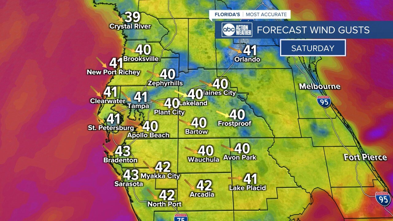
There could be a few spots with localized flooding for those of you north of I-4 that picked up heavy rain on Thursday. After the front exits the area, expect temps to take a big drop from the upper 70s and low 80s ahead of it, to 50s and 60s behind it. Our actual high temps will be set in the morning, while our afternoon temps will be much colder. Winds will also gust to 40 mph at times.
FROST/FREEZE RISK
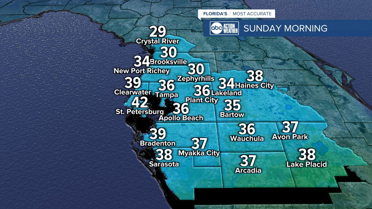
Believe it or not, some of you will experience a freeze Sunday morning! Temps have been record-breaking for the last week, near 90 for many of us. Here's a temp breakdown for Sunday morning:
- NATURE COAST: 29-32° Frost and freeze likely here
- I-4 INLAND: 34-38° Patchy frost possible
- COAST: 39-42° No frost or freeze
- SOUTH OF I-4 INLAND: 35-39° Patchy frost possible
WIND CHILLS
Sunday morning wind chills will fall into the 20s north and 30s south.
After this brief shot of cold air, temps will rise back to near 80 by Monday and Tuesday.