
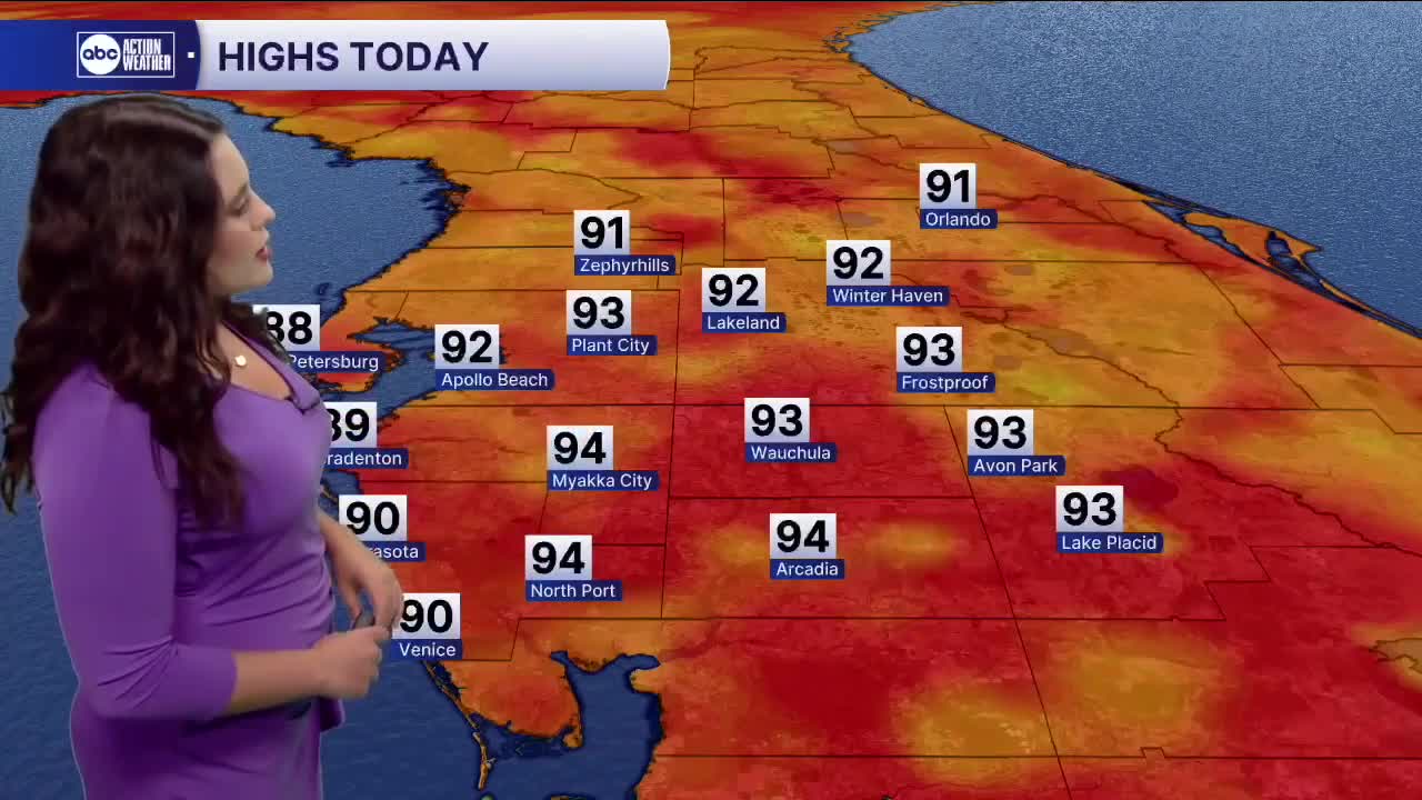


TAMPA — Good Monday morning Tampa Bay! It is a warm and muggy start to the day with highs in the low to mid 90s into the afternoon and evening.. Skies start dry before scattered showers and storms fill in. Drier air filters in mid-week as winds shift out of the north-northeast. Afternoon showers have a better chance inland. Abundant moisture moves in Thursday into the weekend. Higher rain chances and milder temps near 90 stick around.
As of the 2 AM update from the NHC, our yellow X is gone, but our orange blob in the central Atlantic has increased in terms of development. The disorganized area of showers and thunderstorms has a 50% chance of development over the next seven days. A tropical depression could form later on this week. Track still too far out to tell. Erin, on the other hand, is still a beat Category Four hurricane with winds of 130 mph. While Erin turns north, the storm likely brings life-threatening surf and rip currents to most of the US Atlantic coast. No impacts to us in the Tampa Bay area.