


Another round of storms likely later today
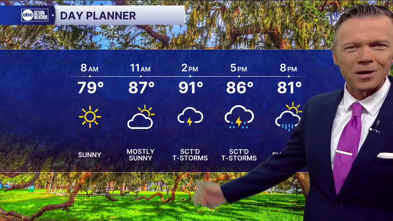
We'll start Thursday dry with temperatures in the 70s and mostly clear skies. Look for sunny and hot weather for the first half of the day with temperatures reaching the low 90s by early afternoon.
After 2pm sct'd rain and storms will begin to develop. They will move southeast to northwest, closer to the coast, along the I-75 corridor. Some may produce localized flooding and frequent lightning. Most of the rain will be done by 8pm.
Look for lower rain chances on Friday with only a few sct'd afternoon and evening storms late in the day. With less rain, Friday will be a little hotter.
If you like heat, you'll love the weekend. A bubble of drier air will make a brief mid-July visit cutting our Saturday-Sunday rain coverage to an unusual 20%. Temperatures will respond with highs in the mid-90s likely in most towns and a heat index well above 100 degrees.
Moisture levels increase by Monday and rain coverage returns to more normal levels of 40-60% for much of next week.
TROPICS: Low pressure in the northern Gulf is unlikely to develop as it will move over south Louisiana today. The rest of the Atlantic looks quiet over the next 7 days.