


More rain is likely today.
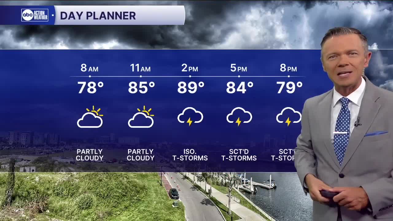
We'll start the day in the 70s with mostly dry weather. Don't expect much rain through midday. After noon, a few pop-up showers are possible near the coast. These will generally be small and brief. The heavier stuff arrives from the east late in the afternoon and evening with the heaviest coverage likely again closer to the coast. The places that saw heavy rain on Thursday are not necessarily the locations that will get it again today. The rain always sets up differently each day.
That'll be the case as well this weekend. Each day will feature heavy rain chances during the afternoons and evenings but neither day will be a washout. Highs on Saturday and Sunday will reach into the 90s before the rain arrives. Rain chances each afternoon will be in the 70% range.
It looks like heavier PM rain coverage will stick around through Monday followed by a return to on-shore flow Tuesday, which will decrease the chances of rain along the coast.
TROPICS: Low pressure off the East Coast is now unlikely to develop as it moves east. Another strong wave in the South Atlantic is likely to develop over the weekend but it will also track north and then away from the United States. This system will not be a threat to land. Another strong wave is coming off the West African coast. This system will track farther south allowing it to make it farther west in the Atlantic basin. Lots of time to watch it. Right now, there is nothing to worry about.