


Highs in the 90s today with a 40% chance of storms.
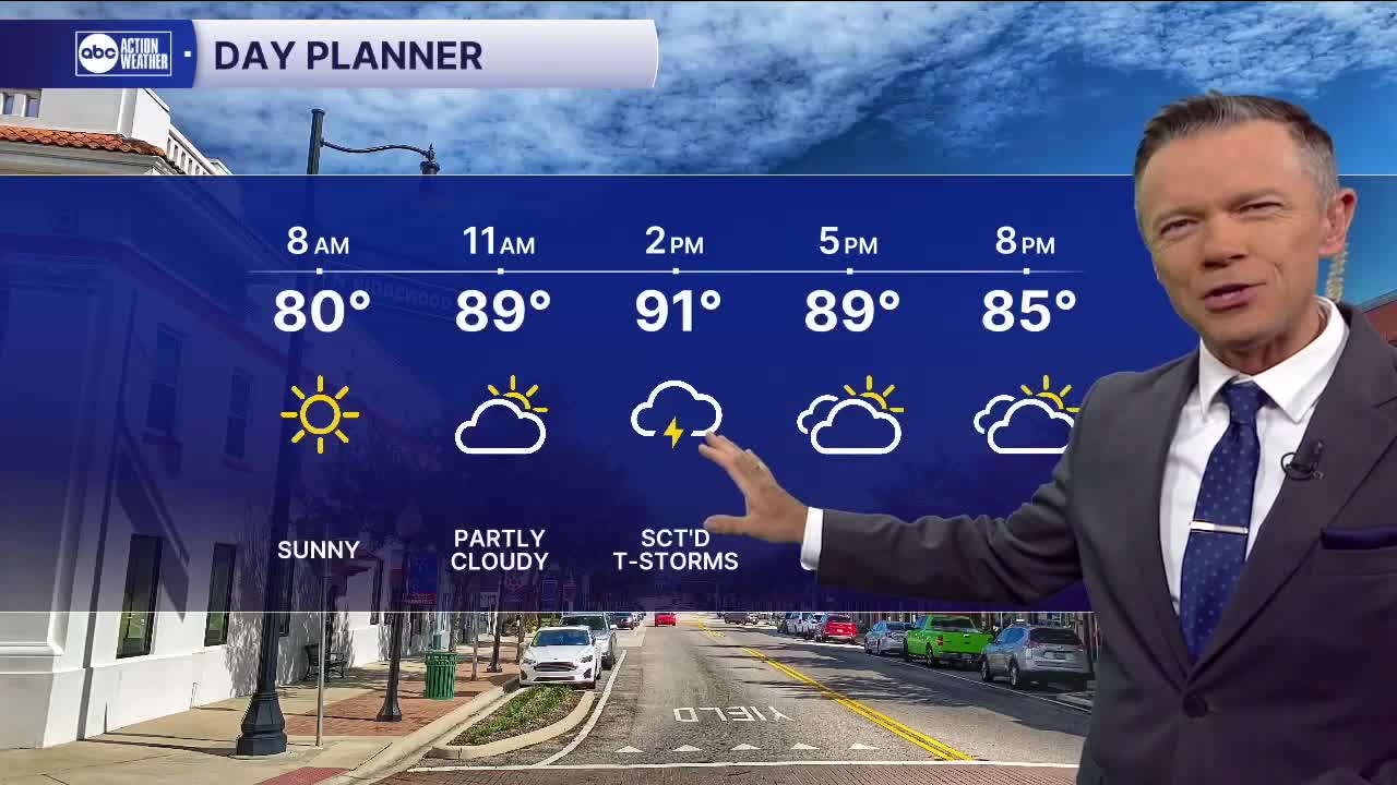
Temperatures this morning will start in the 70s and low 80s. Most will see dry conditions during the morning hours.
Sct'd storms will begin to develop midday today as temperatures reach around 90. The storms will start near the coast first and will shift slowly east through the afternoon and evening. Highs will climb into the low and mid-90s.
The pattern begins to change as we move to Thursday with the winds shifting to more east to west. This will change up our rain timing along the coast. Instead of midday storms, expect the highest rain chances west of I-75 to happen during the late afternoon and evening. Even the beaches will stand to see some evening rain with this type of pattern. Moisture levels will also increase Friday through Sunday, pushing evening rain coverage to at least 60%.
TROPICS: There are a couple of areas that the NHC is watching for potential development through the weekend. One is east of the Carolinas. This system is likely to develop Thursday into Friday but will also move away from the coast as it does. It is not a threat. The second is a wave in the eastern Atlantic. This one is also not likely to impact any land as it turns north into the central Atlantic this weekend.