


Mostly sunny early then evening rain likely.
After yesterday's widespread rains, we're waking up to cooler, more comfortable temperatures this morning. Many towns are down into the 70s this morning, noticeably cooler than it's been over the last couple of mornings.
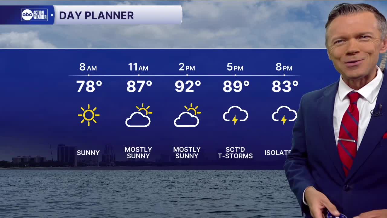
The morning and midday today will be mostly dry and that means also very hot. Highs return to the low 90s today. The rain will return, but later than when we saw it on Wednesday, with the heaviest coverage along I-75 and points west. Some may get more than 2" of rain in a short period of time leading to localized flooding.
Another round of afternoon storms is likely on Friday. Timing and placement will be similar to today, except coverage will likely be down to 40%.
As far as the weekend, don't count on a lot of rain. We'll get a good chance to dry out. Saturday's rain coverage during the afternoon looks to be only in the 10-20% range with maybe slightly more coverage Sunday, up to 30%. Because there will be fewer storms, there will also be more heat. Highs will reach into the mid-90s both weekend days. Heat advisories may be needed for some this weekend.
TROPICS: There is a very low, 10% chance, of something developing from the system currently moving through the Gulf. It's unlikely however that much will come from this storm as it moves west. It's not a threat to Florida and will be ashore in Texas by the weekend.