


Hot today with evening storms.
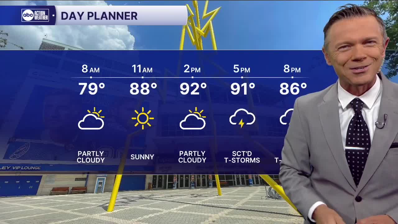
Quiet and sunny to start the day. We'll see morning temperatures in the 70s early in most towns with clear conditions. Look for dry, sunny and hot weather for the first half of the day. Highs will reach the low and mid-90s this afternoon.
Sct'd rain and storms will begin to develop after 4 pm. These storms, at first isolated, will become stronger and more widespread as they cross I-75 after 5 pm leading to the strongest storms between I-75 and the coast this evening. Some will produce intense lightning and maybe even one or two very strong wind gusts.
Rain will be something we will not see a lot of this weekend. Saturday will feature highs in the mid-90s and mid-90s will return on Sunday. Some towns away from the coast this weekend may be above 96 degrees in the afternoon. A couple of isolated showers are possible Saturday with a 20% overall rain chance. Those rain chances will increase to only 30% on Sunday.
TROPICS: Low pressure in the western Gulf will move into Texas by tomorrow bringing with it a chance of sct'd rain and storms to that state. Development is unlikely with this system. Elsewhere in the Atlantic, conditions look to remain quiet through the weekend.