


Heat advisory today from 11 am to 7 pm.
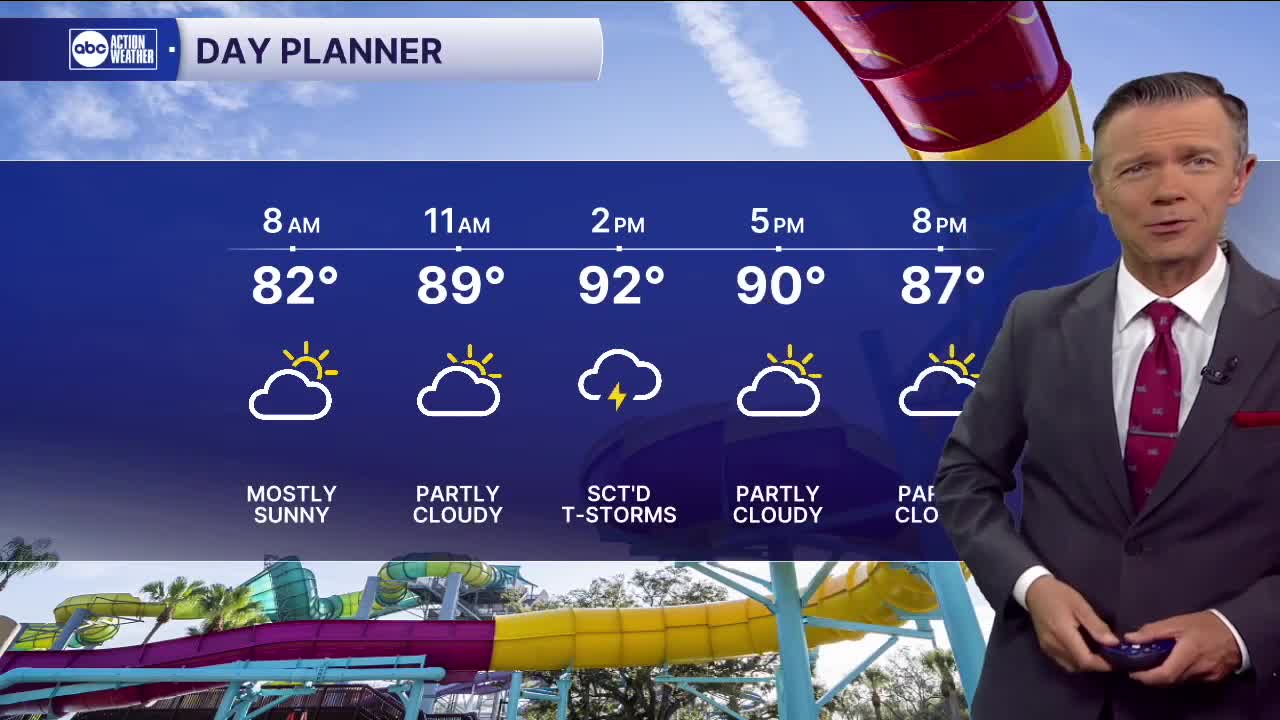
We're waking up to warm temperatures this morning and lots of humidity. Many locations, even away from the coast, are in the 80s to start the day. Highs will climb into the 90s this afternoon with a heat index near 109F. There will be some pop-up storms this afternoon with the rain chance around 40%.
Looks like the rain coverage this weekend will hold steady at around 40-50%. Highs will reach the 90s both weekend days. Most of the storms will begin to form around midday or early afternoon, with the morning hours being mostly dry.
Next week, rain chances will likely pull back a bit, especially beginning on Tuesday, as Erin moves up the east coast and drags down some slightly drier air above us.
TROPICS: A weak area of low pressure will move into South Texas this evening. This system may develop into a depression before it moves over land.
Erin will likely become a hurricane today. The storm will pass far enough north of the Leeward Islands to keep most of its impacts away. A few rain squalls and wind gusts above 40 mph are possible in some of the islands from Anguilla and Barbuda to Puerto Rico and the USVI.
Erin will likely turn away from the US next week with no direct impacts to the east coast. The one place now that may get some significant impacts from the storm is St. Johns Newfoundland, where the storm may pass close to next week.