


Storms arrive later today.
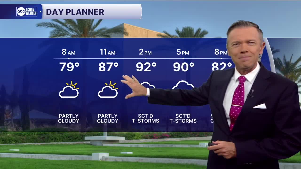
We'll see mostly dry weather to start today and temperatures in the 70s. A couple of pop-up storms are possible right at the coast midday and early afternoon, but the main area of rain won't arrive today until later this evening.
That's because we're switching things up to an offshore flow beginning today and lasting into the weekend. This kind of weather pattern brings us heavy areas of rain and storms from the east, typically late in the afternoon and evening. You're most likely to see the rain west of I-75. This pattern will continue tomorrow and into the weekend.
Over the weekend, the wind will be more out of the southeast, which maximizes rain chances this time of year. Though neither day will be a washout, expect rain chances by late morning each day, and the rain could be on-and-off through the afternoons. With more clouds, some towns this weekend will only see highs in the 80s.
TROPICS: An area of low pressure will develop off the East Coast this weekend and move away from the United States. Out in the Atlantic, another tropical wave is likely to develop by early next week as it turns into the central Atlantic and away from the east coast of the US.