


Temperatures today will start in the low 80s along the coast and the 70s in the interior. There will be a few showers along the coast early. Though they won't be large, anyone under one of these will get some brief heavy rain.
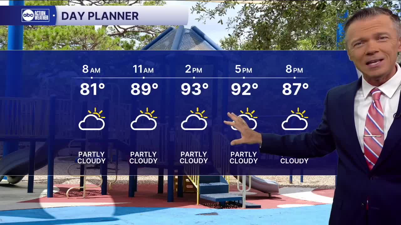
Highs today will reach back into the low and mid-90s with a heat index of 100-105F. A few sct'd pop-ups will be possible west of the coast through the early afternoon. These will then move east of I-75 toward I-95 for the second half of the day and evening.
Expect a similar pattern of temperature and rain on Tuesday and Wednesday too. By late in the weekend, we may try to switch things up a bit with more of an east to west flow. This would allow for slightly lower morning temperatures along the coast with hot and mostly sunny afternoons following by a higher likelihood of evening rain along the beaches.
TROPICS | Tropical storm Dexter is 400 miles east of North Carolina and will move away from the United States. A weak area of low pressure may form later in the week off the southeast US coast and drift around. Out in the Atlantic, a strong wave coming off the coast of Africa is likely to develop in the central Atlantic later this week or weekend. Plenty of time to watch this one as it's more than 10 days away from any land.