
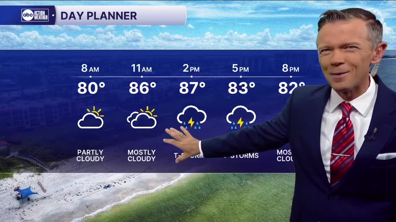


Lots of sct'd rain likely later today.
We'll start the day mostly dry with a few showers near the beaches. The early part of the morning will be dry for most with temperatures in the 70s and low 80s. A few pop-up downpours will be possible along the coast during the second half of the morning as temperatures reach the upper 80s by midday.
Look for numerous sct'd rain and storms during the afternoon. The storms will be widespread and move southeast to northwest. Some will produce locally heavy rain that will likely lead to localized flooding.
Rain coverage looks a bit lower for Thursday, down to 60% with most of the rain coming during the late afternoon and evening. Friday's rain coverage will continue to drop down to around 40%.
Look for only 20-30% rain chances this weekend, with Saturday being the drier of the two. With a lot less rain, we're likely to see a lot more sun and thus some much hotter temperatures with highs well into the 90s both weekend days.
TROPICS: A weak area of low pressure is likely to develop in the north-central Gulf this week. This low pressure will head west toward Texas by the end of the week and the weekend bringing mostly rain. It's unlikely to develop much but could become a tropical depression before moving ashore in the western Gulf.