


Lower than normal rain chances today.
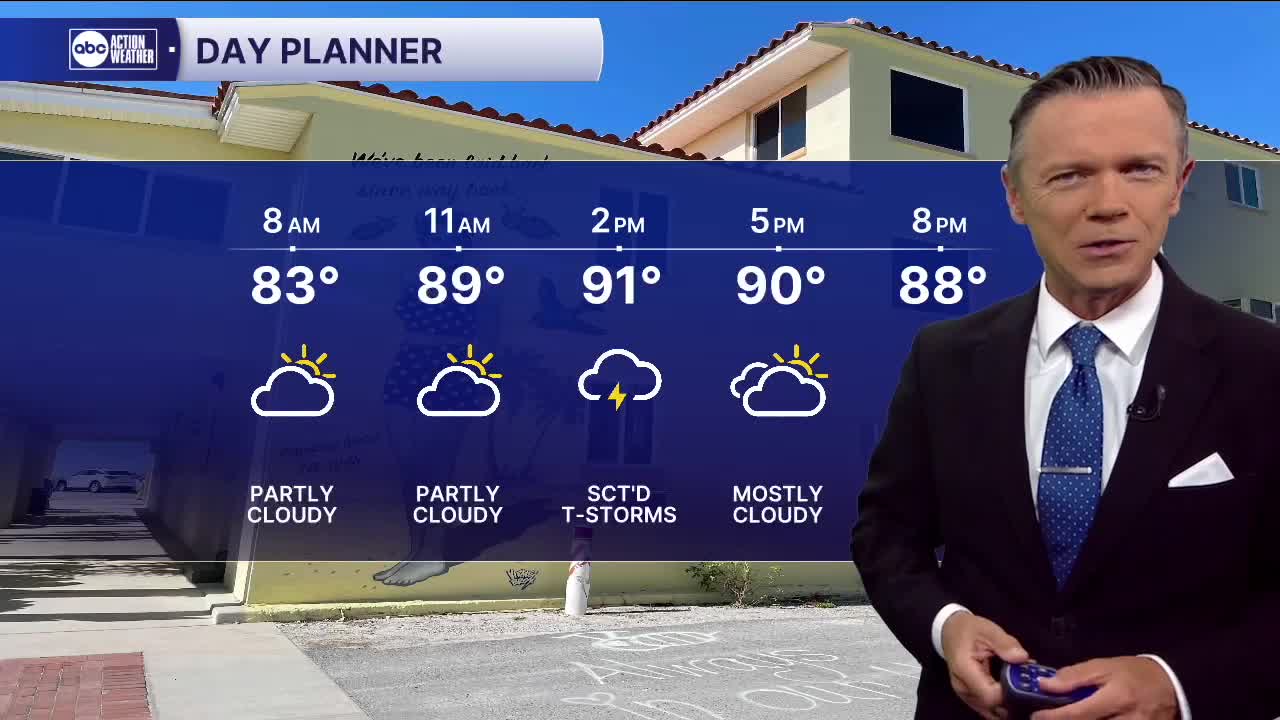
Temperatures in the 70s and low 80s this morning will warm into the 90s this afternoon. Although we do expect some sct'd rain again today, coverage will be lower than is typical in August. Expect the storms to develop along the coast midday and early afternoon with a slow shift east.
It looks like the same pattern will hold on Friday too. We'll generally see 30-40% rain coverage during the afternoon with highs in the 90s.
As far as the weekend, it looks like rain coverage will be a little higher than what we'll see to end the week, but not by much. Look for 40% chance of sct'd PM storms on Saturday and Sunday. The storms may move more from the NE to the southwest during the afternoons.
TROPICS: The latest update on Erin makes no changes to the storm's track. Erin is expected to become a hurricane on Friday and a major hurricane this weekend. The storm is forecast to turn away from the United States early next week. Confidence in this turn is high.