


TAMPA, Fla. — A cold front is bringing a marginal risk for severe thunderstorms to the Tampa Bay area on Thursday.
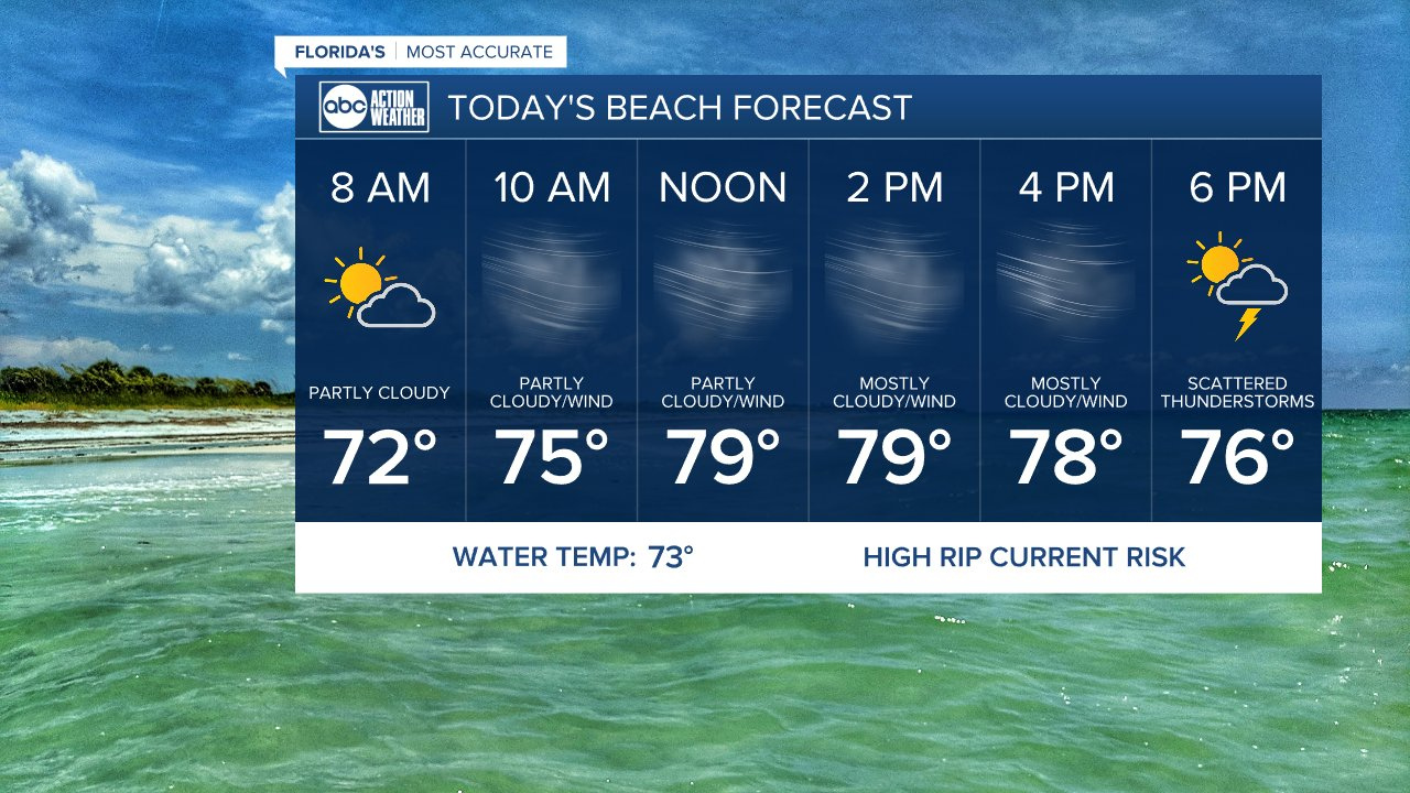
The first half of the day will be dry, windy and warm but by the afternoon storms will begin to move into Citrus and Hernando counties.
Meteorologist Shay Ryan said the line of storms will weaken some as it moves south and east through the area Thursday evening and into Thursday night. Still, the risk of strong to severe storms will continue until as late as midnight.
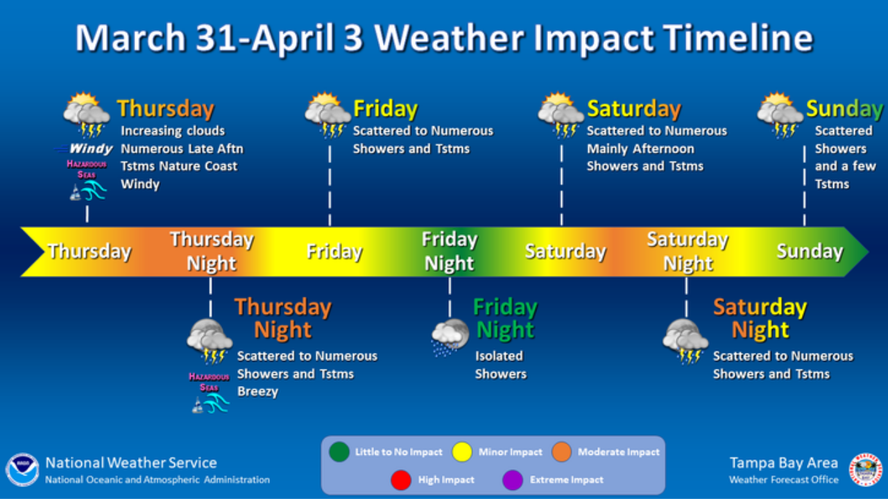
The biggest threat is damaging winds and Ryan said we can't rule out an isolated waterspout or tornado.
There is also a high risk of rip currents and a Small Craft Advisory, which is in place until 10 p.m., due to the storms.
The frontal system will stall out over Florida, which will enhance the chance for rain off and on throughout the weekend.
While there are no watches or warnings in effect for our area, the National Weather Service issued a Tornado Watch for parts of north Florida and Georgia.